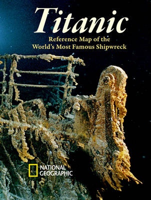
April 15, 2012 marks the 100th anniversary of the sinking of the Titanic. National Geographic Explorer- in-Residence Robert Ballard discovered the wreck in 1985, and the Society will be marking the anniversary with a commemorative map and a host of special events. Due to the mass-appeal of the Titanics story, the anniversary date will be covered by a wide variety of media and retail programs in the U.S. and internationally. National Geographics Titanic 100th Anniversary mapa two-sided infographictells the story of the Titanic from a geographic perspective. The map details the ship's route and wreck site and featuring diagrams, photographs, and information on the ship, its passengers, and its history. The map details the ships fateful route of 1912 and the shipping lanes before and after the disaster; the journey of the fateful iceberg; charts and statistics from the official hearings; an inset locating ice and rescue ships; deep-ocean diagrams of the search process; and Titanic-related points of interest. The ship diagram side of the map features color-coded deck plans, a cutaway view and escape routes; portraits of noted passengers and crew lost and saved; Titanics size compared to the worlds largest objects; and the debate over her future. The Titanic map is available in four different versions: rolled; rolled in a clear plastic presentation tube; laminated; or folded in a polysleeve bag to be merchandized on a hook at retail. Each map is printed in the U.S. on high-quality 80# paper, printed with environmentally-friendly low VOC inks.
April 15, 2012 marks the 100th anniversary of the sinking of the Titanic. National Geographic Explorer- in-Residence Robert Ballard discovered the wreck in 1985, and the Society will be marking the anniversary with a commemorative map and a host of special events. Due to the mass-appeal of the Titanics story, the anniversary date will be covered by a wide variety of media and retail programs in the U.S. and internationally. National Geographics Titanic 100th Anniversary mapa two-sided infographictells the story of the Titanic from a geographic perspective. The map details the ship's route and wreck site and featuring diagrams, photographs, and information on the ship, its passengers, and its history. The map details the ships fateful route of 1912 and the shipping lanes before and after the disaster; the journey of the fateful iceberg; charts and statistics from the official hearings; an inset locating ice and rescue ships; deep-ocean diagrams of the search process; and Titanic-related points of interest. The ship diagram side of the map features color-coded deck plans, a cutaway view and escape routes; portraits of noted passengers and crew lost and saved; Titanics size compared to the worlds largest objects; and the debate over her future. The Titanic map is available in four different versions: rolled; rolled in a clear plastic presentation tube; laminated; or folded in a polysleeve bag to be merchandized on a hook at retail. Each map is printed in the U.S. on high-quality 80# paper, printed with environmentally-friendly low VOC inks.
Founded in 1915 as the Cartographic Group, the first division of National Geographic, National Geographic Maps has been responsible for illustrating the world around us through the art and science of mapmaking.Today, National Geographic Maps continues this mission by creating the world's best wall maps, recreation maps, atlases, and globes which inspire people to care about and explore their world.
Ask a Question About this Product More... |

